
File:Yucatán Peninsula map.png
預覽大小:535 × 599 像素。 其他解析度:214 × 240 像素 | 429 × 480 像素 | 686 × 768 像素 | 914 × 1,024 像素 | 2,500 × 2,800 像素。
原始檔案 (2,500 × 2,800 像素,檔案大小:2.53 MB,MIME 類型:image/png)
| 描述 |
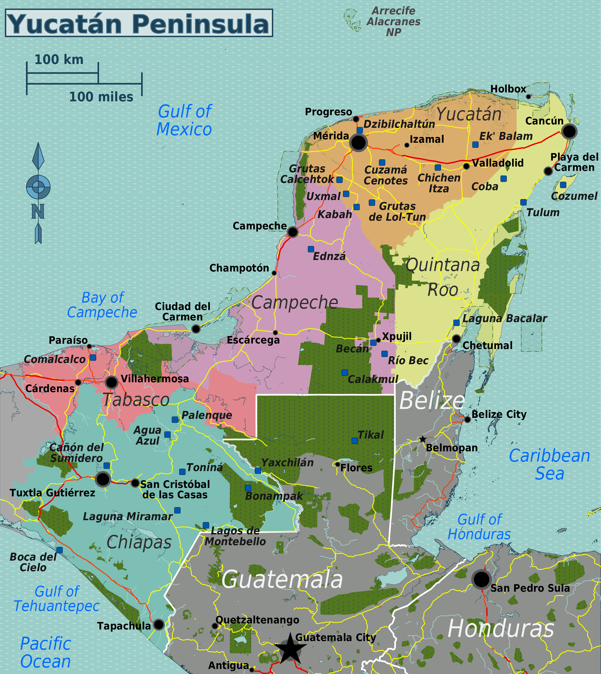
English: Travel map of the Yucatán Peninsula |
|||
| 日期 | ||||
| 來源 | File:Yucatán_Peninsula_map.svg | |||
| 作者 | Peter Fitzgerald, OpenStreetMap | |||
| 授權許可 (重用此檔案) |
此檔案採用共享創意 姓名標示-相同方式分享 2.0 通用版授權條款。
|
檔案歷史
點選日期/時間以檢視該時間的檔案版本。
| 日期/時間 | 縮圖 | 尺寸 | 用戶 | 備註 | |
|---|---|---|---|---|---|
| 目前 | 2013年6月10日 (一) 05:51 | | 2,500 × 2,800(2.53 MB) | Peterfitzgerald | {{Information |Description ={{en|1=Travel map of the Yucatán Peninsula}} |Source =File:Yucatán_Peninsula_map.svg |Author =Peter Fitzgerald, [http://openstreetmap.org OpenStreetMap] |Date =201... |
檔案用途
下列頁面有用到此檔案:
全域檔案使用狀況
以下其他 wiki 使用了這個檔案:
- el.wikivoyage.org 的使用狀況
- en.wikivoyage.org 的使用狀況
- fr.wikivoyage.org 的使用狀況
- he.wikivoyage.org 的使用狀況
- hu.wikipedia.org 的使用狀況
- it.wikivoyage.org 的使用狀況